Queen Creek is surrounded by trails highlighting the Sonoran Desert, mountain ridges, and preserved natural spaces. For those looking to explore on foot, the region offers a range of options that showcase different landscapes and trail experiences. Whether you choose the structured loops of Desert Mountain Park, the expansive ridges of San Tan Mountain, or the rugged Superstition Wilderness, each trail highlights a different aspect of Arizona’s landscape.
This guide to hiking in Queen Creek outlines the best places nearby to immerse yourself in Arizona’s unique outdoor settings.
San Tan Mountain Regional Park
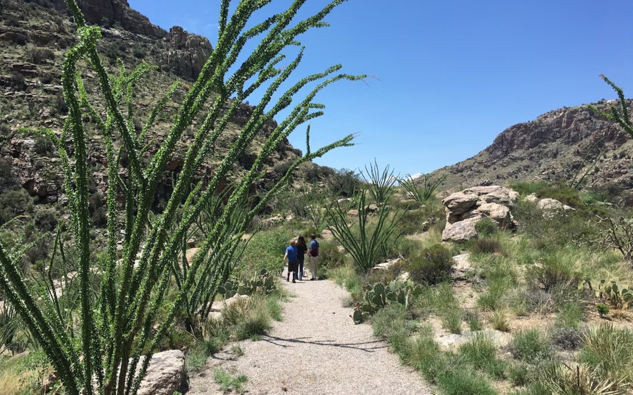
San Tan Mountain Regional Park sits just west of Queen Creek and spans over 10,000 acres. The park includes an extensive network of trails ranging from short loops to longer treks, giving hikers plenty of choices. The San Tan Trail is one of the most popular routes, offering expansive desert views and a clear sense of the park’s terrain. You will encounter saguaro, cholla, and ocotillo along the way and scenic ridges that make the hike rewarding.
The park also offers other routes like the Goldmine Trail and Moonlight Trail, which vary in length and elevation. Each path offers something distinct, from panoramic overlooks to strolls through desert washes. San Tan Mountain Regional Park is a key destination for hiking in Queen Creek, giving residents and visitors a comprehensive look at the desert environment.
The park also offers other routes like the Goldmine Trail and Moonlight Trail, which vary in length and elevation. Each path offers something distinct, from panoramic overlooks to strolls through desert washes. San Tan Mountain Regional Park is a key destination for hiking in Queen Creek, giving residents and visitors a comprehensive look at the desert environment.
Desert Mountain Park Trail System
Desert Mountain Park is located within Queen Creek and offers convenient access to local trails. While smaller in scale than regional parks, this area provides well-maintained paths ideal for shorter outings. The park includes walking routes that loop around sports fields, desert landscaping, and shaded rest areas, making it a good choice for a casual hike within town limits.
The advantage of this location lies in its accessibility. If you live nearby or have limited time, you can enjoy a quick hike without leaving Queen Creek. Desert Mountain Park may not offer the rugged terrain of mountain ranges, but it provides an excellent introduction to hiking in Queen Creek within a more structured environment.
The advantage of this location lies in its accessibility. If you live nearby or have limited time, you can enjoy a quick hike without leaving Queen Creek. Desert Mountain Park may not offer the rugged terrain of mountain ranges, but it provides an excellent introduction to hiking in Queen Creek within a more structured environment.
Usery Mountain Regional Park
Just north of Queen Creek in Mesa, Usery Mountain Regional Park delivers some of the most scenic hikes in the region. The Wind Cave Trail is the standout, leading hikers up to a natural cave opening in the mountain face. The ascent provides wide-ranging views across the desert floor, and the destination offers a distinct reward.
The park also has flatter, easier trails like Blevins Trail and Pass Mountain Trail, which circle through washes and cactus stands. Usery is known for its well-marked paths and wide selection, making it suitable for those looking to customize their hike based on time and endurance.
The park also has flatter, easier trails like Blevins Trail and Pass Mountain Trail, which circle through washes and cactus stands. Usery is known for its well-marked paths and wide selection, making it suitable for those looking to customize their hike based on time and endurance.
Queen Creek Wash Trail
The Queen Creek Wash Trail is a paved multi-use path running through the heart of town. While it differs from rugged desert hiking, it is vital in connecting neighborhoods and providing a straightforward outdoor option. The trail is ideal for walking, jogging, or cycling, with shaded sections that follow landscaped corridors.
This route is beneficial for those who want an everyday exercise trail. It provides a continuous stretch for longer walks without driving to a regional park. Though it lacks steep climbs or desert panoramas, the Queen Creek Wash Trail supports an active lifestyle and adds to the network of trails accessible to residents.
This route is beneficial for those who want an everyday exercise trail. It provides a continuous stretch for longer walks without driving to a regional park. Though it lacks steep climbs or desert panoramas, the Queen Creek Wash Trail supports an active lifestyle and adds to the network of trails accessible to residents.
Boyce Thompson Arboretum
Located a short drive east near Superior, Boyce Thompson Arboretum offers a unique blend of botanical gardens and desert hiking. The trails wind through collections of desert plants from around the world and natural desert terrain. The Main Trail takes visitors past cactus gardens, a eucalyptus grove, and riparian habitats.
The Arboretum’s combination of cultivated and wild landscapes distinguishes it among hiking options. In a single outing, you can experience both designed pathways and natural desert washes. This mix creates a setting that appeals to hikers who want scenic exploration and educational opportunities.
The Arboretum’s combination of cultivated and wild landscapes distinguishes it among hiking options. In a single outing, you can experience both designed pathways and natural desert washes. This mix creates a setting that appeals to hikers who want scenic exploration and educational opportunities.
Peralta Trail in the Superstition Mountains
About 30 minutes from Queen Creek, the Peralta Trail is one of the most recognized hiking routes in the Superstition Wilderness. It leads to Fremont Saddle, where hikers are rewarded with an iconic view of Weaver’s Needle, a striking rock formation. The trail involves steady climbing but is well-maintained and highly trafficked.
The rugged landscape here contrasts with the smoother desert terrain closer to town. The Superstition Mountains offer jagged cliffs, volcanic rock formations, and dramatic views. For those willing to venture further, the Peralta Trail provides a challenging and memorable experience, demonstrating why Arizona hiking is so celebrated.
The rugged landscape here contrasts with the smoother desert terrain closer to town. The Superstition Mountains offer jagged cliffs, volcanic rock formations, and dramatic views. For those willing to venture further, the Peralta Trail provides a challenging and memorable experience, demonstrating why Arizona hiking is so celebrated.
Gold Canyon Trails
South of Queen Creek, Gold Canyon features an extensive trail system connected to the Superstition Mountains. Trails like Hieroglyphic Trail provide access to petroglyphs carved into rock faces, adding a cultural and historical element to the hike. Other routes explore washes, rolling foothills, and desert ridges.
These trails offer flexibility in distance and difficulty. Shorter loops can be completed in under an hour, while longer treks extend deep into mountain canyons. The scenery is diverse, with each trail offering different focal points such as boulder fields, desert wildflowers, or ancient carvings.
These trails offer flexibility in distance and difficulty. Shorter loops can be completed in under an hour, while longer treks extend deep into mountain canyons. The scenery is diverse, with each trail offering different focal points such as boulder fields, desert wildflowers, or ancient carvings.
Lost Dutchman State Park
Lost Dutchman State Park, located near Apache Junction, is another major hub for hiking close to Queen Creek. Trails here include the Treasure Loop, Siphon Draw, and Jacob’s Crosscut, each providing different ways to experience the base of the Superstition Mountains. Siphon Draw is particularly popular for those climbing toward Flatiron, one of the area’s most famous peaks.
The park combines accessibility with rugged beauty. Many trails start directly from the parking area, allowing quick access to desert scenery. Whether you prefer short hikes or full-day climbs, Lost Dutchman State Park provides options that appeal to many hikers.
The park combines accessibility with rugged beauty. Many trails start directly from the parking area, allowing quick access to desert scenery. Whether you prefer short hikes or full-day climbs, Lost Dutchman State Park provides options that appeal to many hikers.
Find Your Niche in Queen Creek with Openshaw Real Estate Group
If you see yourself hiking these trails from your home base in Queen Creek, finding the right home is the first step toward making it a reality. Whether seeking proximity to trails, parks, or equestrian facilities, contact the Openshaw Real Estate Group today to begin your journey to living fully outdoors in Queen Creek.