Homes for Sale in Glendale Arizona
Living in Glendale, AZ
Everything you need to know about moving to Glendale: a historic downtown, a major sports and entertainment district, and a genuinely wide range of neighborhoods across the West Valley.
Your Complete Relocation Guide · Updated August 2026
Glendale's population as of the U.S. Census Bureau's July 1, 2023 estimate (V2023), up 2.2% from the April 1, 2020 estimates base of 248,403. Glendale is the 6th most populous city in Arizona, according to the Census Bureau's most recent population figures.
01 — Cost of Living
Priced below the East Valley, with real variation by neighborhood
Per the U.S. Census Bureau, Glendale's median household income (2019-2023, in 2023 dollars) is $70,139. Data USA, using 2024 American Community Survey figures, reports a median property value of $387,500 and a homeownership rate of 57.2%. Arizona levies a flat state income tax, currently 2.5%.
Category | Glendale | Source |
|---|---|---|
Median Household Income (2019-2023) | $70,139 | U.S. Census Bureau QuickFacts |
Median Property Value (2024) | $387,500 | Data USA (ACS 2024) |
Homeownership Rate | 57.2% | Data USA (ACS 2024) |
Poverty Rate | 15.1% | Data USA (ACS 2024) |
State Income Tax | 2.5% flat (Arizona) | Arizona Dept. of Revenue |
02 — Neighborhoods
A city of genuinely distinct districts
Glendale spans a historic southern core and a newer, master-planned northern half, and local real estate reporting describes real price separation between the two. Confirm which part of the city, and which school district, applies to any specific address.
Historic Downtown Glendale
Known locally as "Arizona's Antique Capital," with boutique and antique shops, Cerreta Candy Company, and Glendale's original town core.
Westgate / Sports & Entertainment District
Home to State Farm Stadium, Desert Diamond Arena, and the Westgate Entertainment District, with newer residential development close to the stadium district.
Arrowhead Ranch (North Glendale)
$575K-$920K
A master-planned community built around the Arrowhead Towne Center mall, zoned to the Deer Valley Unified School District, and reported to carry the city's highest home prices.
Central & Historic Core
$285K-$400K
Older, more established neighborhoods closer to downtown, reported to trade at the city's lower end, generally zoned to Glendale Elementary District and Glendale Union High School District.
Neighborhood price ranges are drawn from a single local market report (Arizona Homes and Condos, May 2026 data) and should be confirmed against current listings for a specific address.
03 — Weather
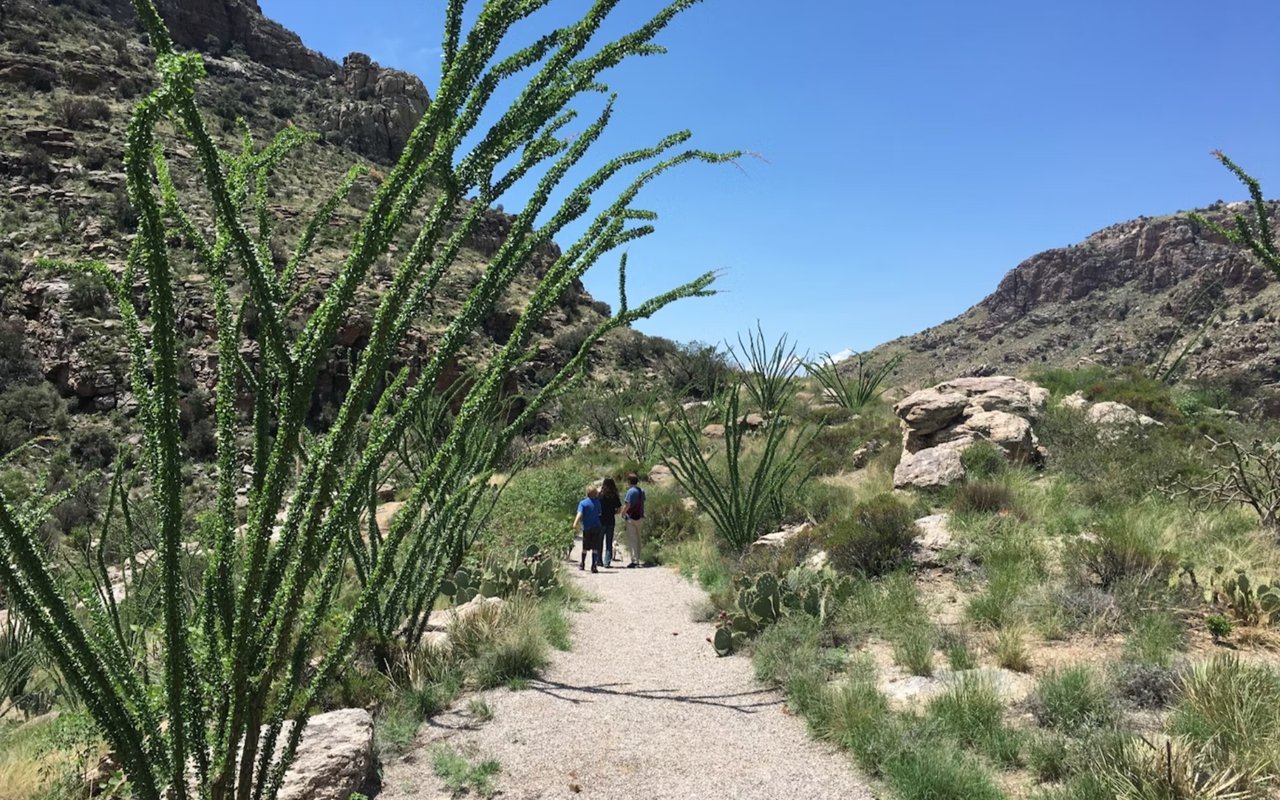
A hot desert climate
Per HomeSnacks, using NOAA climate data, Glendale's average high temperature is 85.8°F and its average low is 58.1°F. Glendale receives an average of 9.3 inches of precipitation across 20.6 days of precipitation per year, and 0.0 inches of snow annually.
85.8° / 58.1°
9.3"
0.0"
04 — Jobs & Economy
Anchored by Luke Air Force Base, healthcare, and manufacturing
Luke Air Force Base, located just west of Glendale, is documented as one of the largest fighter pilot training installations in the world and serves as the U.S. Air Force's primary F-35 training site. Per Data USA (2024 ACS figures), the most common employment sectors for Glendale residents are Retail Trade (16,779 people), Health Care & Social Assistance (16,194 people), and Construction (11,334 people); citywide employment grew 3.53% from 2023 to 2024, from about 118,000 to 122,000 employees.
05 — Schools
Four overlapping districts, with real variation between them
Glendale is served by four overlapping school districts, and a specific address's zoned district varies significantly across the city. According to a local Arizona real estate market report citing Local Education Agency (LEA) grades, Glendale Union High School District and Deer Valley Unified School District each hold an A grade, while Glendale Elementary District and Peoria Unified School District each hold a B grade. Deer Valley Unified serves the Arrowhead Ranch area in north Glendale.
06 — Getting Around
Loop 101 connects Glendale across the West Valley
Glendale is located in Maricopa County, documented as approximately nine miles northwest of downtown Phoenix. The completion of Loop 101, according to city history records, connected Glendale to the broader Phoenix metro area and supported development around Arrowhead Ranch.
Glendale is served by the Loop 101 (Agua Fria Freeway) and Grand Avenue. Drive time estimates to specific destinations vary by exact origin and traffic conditions; consult a mapping service for a specific address.
07 — Safety
Above the national average citywide, with significant variation by area
According to HomeSnacks' analysis of FBI Uniform Crime Report data, Glendale's total crime rate is 3,159.1 per 100,000 people, 49.07% higher than the national rate of 2,119.2 per 100,000. The same source reports a violent crime rate of 488.4 per 100,000, 36.05% higher than the national rate of 359.0 per 100,000. NeighborhoodScout separately reports that Glendale has one of the highest rates of motor vehicle theft in the nation, based on its analysis of FBI crime data.
Category | Glendale | National Rate (FBI) |
|---|---|---|
Overall Crime Rate (per 100K) | 3,159.1 | 2,119.2 |
Violent Crime Rate (per 100K) | 488.4 | 359.0 |
Arizona Statewide Rate (per 100K) | 2,214.0 | for reference |
08 — Things to Do
Major-league sports, spring training, and a historic downtown
Few Phoenix-area suburbs combine professional sports, spring training baseball, and historic small-town character the way Glendale does.
- State Farm Stadium — home of the NFL's Arizona Cardinals; has hosted the Super Bowl in 2008, 2015, and 2023
- Desert Diamond Arena — concerts and events in the Sports and Entertainment District
- Camelback Ranch-Glendale — spring training home of the Los Angeles Dodgers and Chicago White Sox
- Sahuaro Ranch Park — historic ranch property and park
- Historic Downtown Glendale — known as "Arizona's Antique Capital"
- Thunderbird Conservation Park — nature preserve in north Glendale
- Westgate Entertainment District — outdoor shopping, dining, and entertainment near the stadium
- Arrowhead Towne Center — regional mall in north Glendale, opened 1993
09 — Real Estate Market
A market that varies meaningfully by exact source and month
Multiple data sources report slightly different figures for Glendale, reflecting differences in methodology, property mix, and reporting period; each is cited individually below rather than averaged together.
10 — Buying & Selling in Glendale
What buyers and sellers need to know
Whether you're searching for homes for sale in Glendale or preparing to list, a few details matter given how much this city varies by area.
- Confirm which of the four school districts serves a specific address. LEA grades reported for Glendale's districts range from A to B, and boundaries don't follow a single simple pattern.
- Review neighborhood-specific crime data. Citywide FBI figures run above the national average, but reported neighborhood-level variation is significant.
- Ask about vehicle security. NeighborhoodScout's analysis of FBI data reports one of the nation's highest motor vehicle theft rates for Glendale; garages or monitored parking are worth prioritizing.
- Budget for Arizona's income tax. The state's flat 2.5% rate applies statewide.
- Weigh proximity to Luke Air Force Base. Some areas fall within designated aircraft noise zones; ask about this directly for any specific address.
- Lead with your specific school district's grade. An A-rated Deer Valley or Glendale Union zone is a genuine, citable differentiator; a general Glendale claim is not.
- Price against comparables in the same sub-area. Reported prices range from roughly $285,000 in the historic core to $920,000 in Arrowhead Ranch; citywide averages don't reflect either extreme accurately.
- Highlight proximity to major employers and venues. Distance to Luke Air Force Base, Banner Thunderbird, or the Westgate district is a genuine draw for specific buyer groups.
- Expect a somewhat longer marketing window than a year ago. Redfin reports median days on market up from 51 to 57 year over year.
- Work with a local agent who tracks sub-area pricing. Given how much Glendale varies block to block, general Phoenix-metro knowledge isn't sufficient.
Sources & References
All information is deemed reliable but not guaranteed and should be independently reviewed and verified. Figures are attributed to their original source and dated as reported; where sources disagree, both are noted rather than averaged.
Ready to explore houses for sale in Glendale Arizona?
Openshaw Real Estate Group specializes in helping buyers and sellers navigate real estate across Glendale and the greater Phoenix metro. Whether you need an agent who knows every school district and neighborhood or an experienced team that can find properties for sale in Glendale that match your goals, we are here to help.
Neighborhood Guide






































Get in Touch
830 S Higley Rd Gilbert AZ 85296
Get in Touch
Get in Touch
830 S Higley Rd Gilbert AZ 85296